Case Studies

DRONE FLORA SURVEYING TO LOCATE, IDENTIFY AND PRESERVE SPECIES

Project background

The RemSense team was engaged by IGE to survey 30 sites, approximately 300km north of Perth, WA. All sites were extremely overgrown with thick undergrowth, scrub, and trees.

The aim of the survey was to provide “a detailed flora survey of the disturbance footprint and an area of at least 50 meters surrounding the disturbance footprint” as specified by the EPA requirement.

The drone survey was completed in two working days for all 30 sites with a two-person crew.

key challenges

The overgrown site earmarked for wind farm development presented a significant challenge.
These areas were virtually impenetrable due to the density of vegetation, making it impossible for people to access them for traditional surveys.

Our Solution

To address this challenge, RemSense employed a UAV mapping system, utilizing the iXM Phase One camera with a 35mm lens mounted on one of our drones.

The team surveyed 24 potential wind generator sites and 5 other areas designated for new supporting infrastructure.

The data collected was of very high quality and geo-referenced.

This data was crucial for assessing the impact in areas slated for the removal of flora and for monitoring the vegetation in the surrounding buffer zone.

The UAV survey provided the detailed flora survey required by the EPA efficiently and accurately.

Results

The drone survey was completed in two working days for all 30 sites with a two-person crew.

Survey details include 24 site areas at 0.12 hectares (250m x 50m) and 5 site areas of assorted sizes, with a flight speed of 5m/s, flight height at 50m AGL, a GSD of 0.54cm/px, and a total of 13,788 images captured.  The 13,788 images were then processed using Pix4D matic to produce 30 geo-tiff ortho-mosaics. These were viewed in QGIS, Global Mapper, and imported for each site. All data processing was completed in-house at our RemSense office.

This case study illustrates the value of drone land surveying for parties wishing to repurpose overgrown sites for new development as well as monitoring fauna in areas otherwise inaccessible.

Using a combination of UAV and photogrammetry, the RemSense team worked quickly and efficiently without disturbing the ecology or placing any personnel at risk.

The detailed images generated by the Phase One camera enabled the team to identify which flora would remain and which would be cleared in preparation for the construction phase.

By using drones for environmental surveying, the client was able to save many days on-site, attempting to access very inaccessible locations.

Feedback

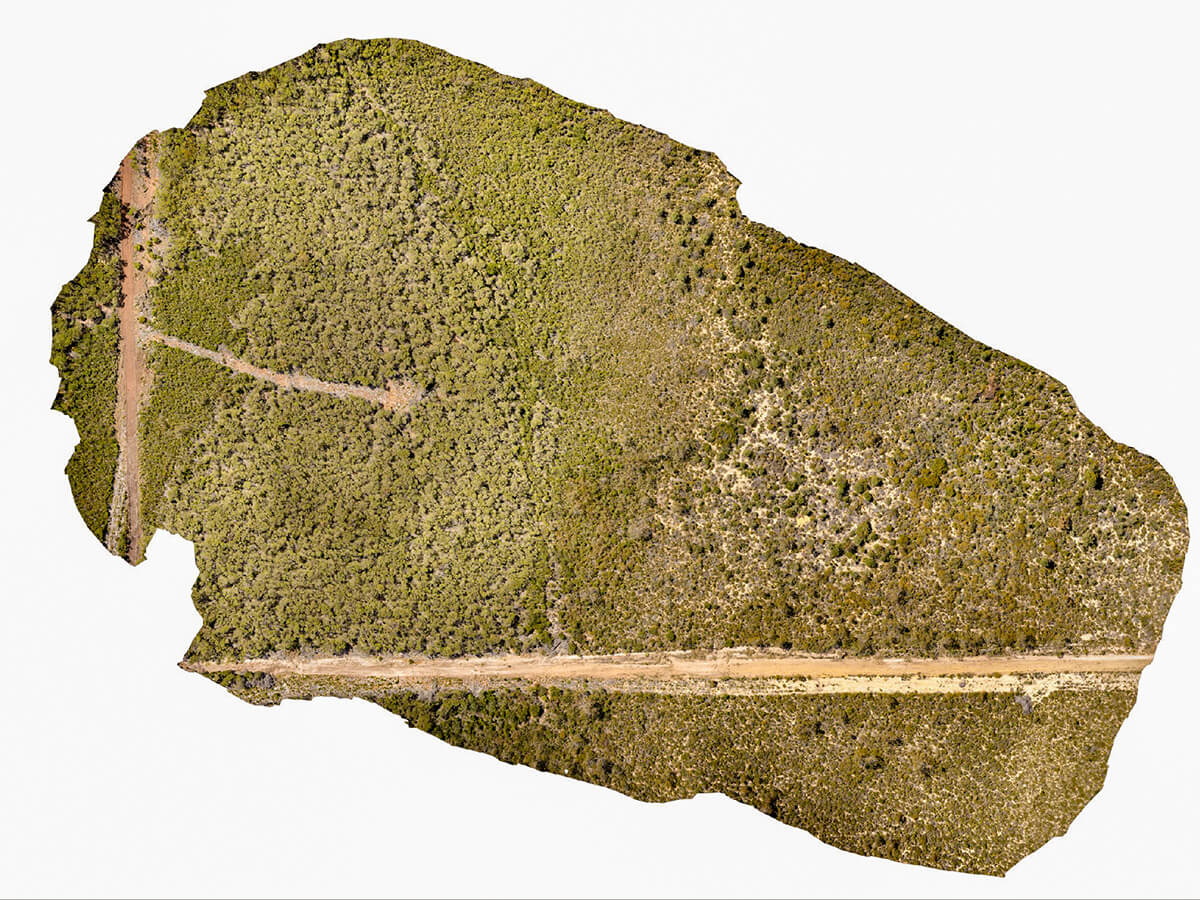
RemSense were professional in the assistance with scoping the job requirements and followed up by completing the site work to a safe and efficient manner reflective of a professional company.
The outcome to IGE was a very high standard result achieving the required images to progress our project deliverables in a short tasking delivery schedule.

Michael Hutt
Construction Manager

project media

GET IN TOUCH

We would love to talk about how we can create
solutions to help your business.

Schedule a FREE demo of our software

The future of Asset Management is just one click away

This website uses cookies to ensure you get the best experience on our site. To find out more read our privacy policy.