Australia and Bushfires
Australia has faced devastating bushfires in recent decdes, with catastrophic wildfires threatening lives, wildlife, and the environment. The 2019-2020 bushfire season, often referred to as “Black Summer”, was one of the most destructive in Australian history, burning millions of hectares, claiming over 30 lives, and destroying more than 5,900 buildings, including 2,800 homes. In addition to the human cost, the fires led to the loss of an estimated 1.25 billion animals, decimating ecosystems and pushing Australia’s biodiversity to the brink.

With climate change contributing to rising temperatures, the frequency and intensity of bushfires in Australia are expected to increase, creating ongoing challenges for firefighting efforts and land management. The urgent need for improved fire prevention and response strategies has never been greater.
How are we preparing for another ‘Black Summer’?
Experts warn that Australia may face another devastating bushfire season, with increased risks due to rising temperatures. To better prepare for future fires, it is essential to equip emergency responders with the right tools and data to respond quickly and effectively.
During the most severe fires, up to 2,700 firefighters were deployed at any given time in New South Wales, while aircraft such as helicopters, fixed-wing aircraft, and air tankers were crucial in firefighting efforts. These aircrafts are used for water and retardant drops, essential for controlling fires and limiting their spread. However, these manned aircraft come with high operational costs and safety risks, particularly in such dangerous conditions.

What is the Australian Government doing to prevent fires?
To prevent and manage bushfires, the Australian government has implemented strategies like prescribed buring (controlled burns), which are designed to reduce fuel loads in forests, parks, and other landscapes. This method not only helps protect properties but also preserves ecosystems that rely on fire for regeneration. While prescribed burning has been effective, traditional methods rely on expensive manned aircraft and come with risks to personnel.
RemSense: Pioneering Drone Technology for Bushfire Management
Flying low and slow in a single-engine helicopter while igniting fire below the aircraft is obviously very, very dangerous. This offers a very compelling justification for using drones for aerial ignition instead of manned aircraft.

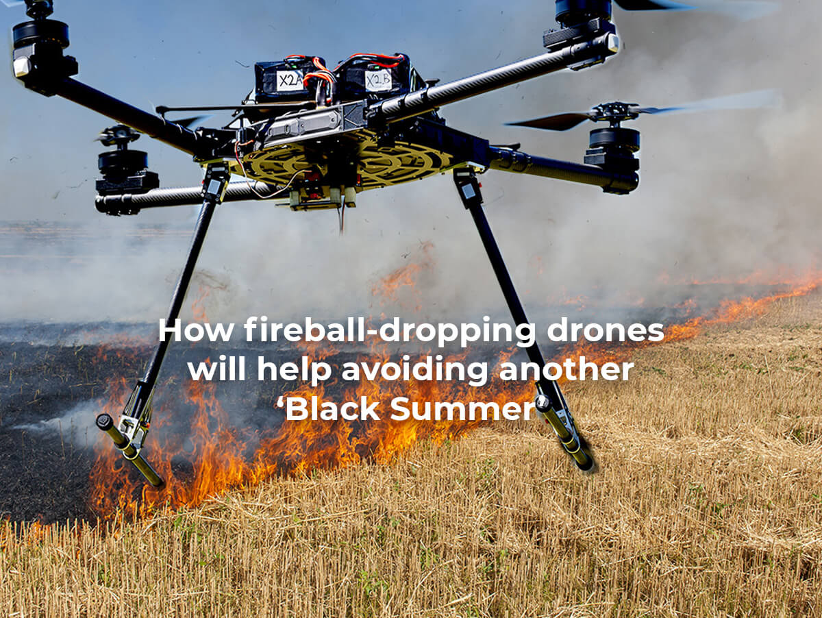
At RemSense, we have pioneered the use of drone technology for aerial ignition and land management. With over 15 years of experience in deploying drone services, we have expanded our portfolio with the cutting-edge FreeFly Alta X drone. This drone is a game-changer, with features that make it highly versatile and capable of transforming the approach to fire management.
Thanks to this addition, we started a collaboration with Raindance Systems a WA Based leader in Incendiary Device Technology. This partnership allows us to pioneer a unique drone solution designed to revolutionise the global approach to backburning, fuel load reduction, carbon abatement, and sequestration initiatives. This innovation positions Western Australia as a vanguard and catalyst, inspiring other nations to adopt similar advancements.
The introduction of this aerial ignition system represents a pivotal moment for the emergency response, environmental, and land management sectors, particularly in their efforts to combat and prevent bushfires. This new drone methodology features:
Key Features of the FreeFly Alta X Drone
- Open-sourced design: allows for the use of various payloads, flight batteries, and controllers to meet operational needs
- ActiveBlade Technology: reduces vibration by 80%, extending component life and improving data quality
- Extended operational flight time: 45 minutes with Phase One 100MP camera (2kg) or Raindance R4/500 (2.4kg) and 40 minutes with LiDAR (5kg), reducing the need for battery swaps and enhaing efficiency
- Large payload capacity: supports a maximum payload of 15kg, enabling the use of multiple sensors, including Lidar, Gas and VOC, Thermal, RGB, Multispectral,Hyperspectral, Aerial Ignition, Equipment winches and Droppers, and more
- Highly customisable: compatible with a wide range of sensors and equipment for precise data collection and mission execution
- Unique folding mechanism: allows the aircraft to pack down to half of its deployed size, making it highly portable for a UAV of its size
How does this help people in the field and reduce land management costs?
The advanced capabilities of this drone system provide numerous advantages for both emergency responders and land management teams. One of the key features is its ability to deploy incendiary capsules, also known as fireballs or fire pills, swiftly and accurately from the air. This capability is invaluable for supporting ground crews during emergency bushfire responses, providing a safer, more efficient method for controlled burns and backburning operations.
Precision and Cost Efficiency in Controlled Burns
Conservation and land management departments can leverage this drone technology to carry out controlled burns, effectively reducing fire fuel loads in preparation for bushfire season. The drone’s GPS guidance system ensures precise planning, allowing for meticulous control over burn areas. The added precision logging functionality makes it easier to track and analyse burn programs over time, simplifying year-to-year evaluations.
This drone’s cost efficiency becomes evident when compared to maintaining manned aviation standby services, such as helicopters. Helicopters are costly to operate, especially for smaller burn areas that may not justify their use. By deploying drones for smaller, more precise aerial burns, land management agencies can manage fire fuel loads efficiently and cost-effectively. This method allows departments to exercise precise control over parameters like heat, speed, and smoke/heat emissions, especially when proximity to urban areas is a concern.
Carbon Abatement and Sequestration
When combined with a carbon abatement and sequestration credit scheme, this drone can help offset its operational costs, making it a financially sustainable solution. The drone’s ability to operate during nighttime – when helicopters are grounded – also extends the operational window, providing greater flexibility in adhering to planned burn schedules and reducing delays.
Increased Safety and Access to Hard-to-Reach Areas
Beyond cost savings, the drone’s ability to access areas that are difficult or unsafe for personnel to reach is a major safety advantage. By reducing the number of personnel exposed to dangerous conditions, it enhances operational safety while ensuring that fire management efforts can continue without putting human lives at risk.

The multifaceted benefits of this drone system go beyond reducing costs. It increases operational efficiency, enhances safety, and offers land management departments a cutting-edge solution for effective bushfire management and fire fuel load reduction
How drones can help further?
In addition to aerial ignition, remotely piloted aircraft offer significant advantages for bushfire management and land conservation efforts:
- Identifying hotspots: drones can detect areas of intense heat, allowing for quick identification of potential fire threats
- Early bushfire detection: equipped with thermal cameras, drones help detect fires in their earliest stages, enabling faster response times
- Providing real-time situational awareness: drones offer live video feeds, giving fire crews critical information in real time
- Detecting people and animals in need: drones can be equipped with thermal snesors to detect people or animals trapped or in danger
- Mapping fire perimeter: drones provide accurate mapping of fire boundaries, helping to plan containment strategies and resource allocation
- Delivering water or equipment for firefighters: drones can deliver small amounts of equipment or water to remote locations, supporting ground crews
- Offering a bird’s eye view perspective: drones provide an elevated view of wildfires, giving firefighters additional insights into fire behaviour and surroundings
- Identifying areas needing attention: drones can identify critical areas that require immediate action to prevent fire spread or mitigate damage.
These capabilities make drones a powerful tool in modern bushfire management, offering critical support for firefighting efforst and improving overall efficiency and safety in land management.
Enquire today
If you’re ready to explore how RemSense’s drone technology can revolutionise your land management strategies and bushfire response efforts.
*source: https://www.abc.net.au/news/2010-04-19/firefighting-choppers-cost-millions-on-stand-by/401846# Helen Brown: ABC TV
* Link: https://www.theguardian.com/australia-news/2023/aug/23/australian-bushfire-season-how-to-prepare.